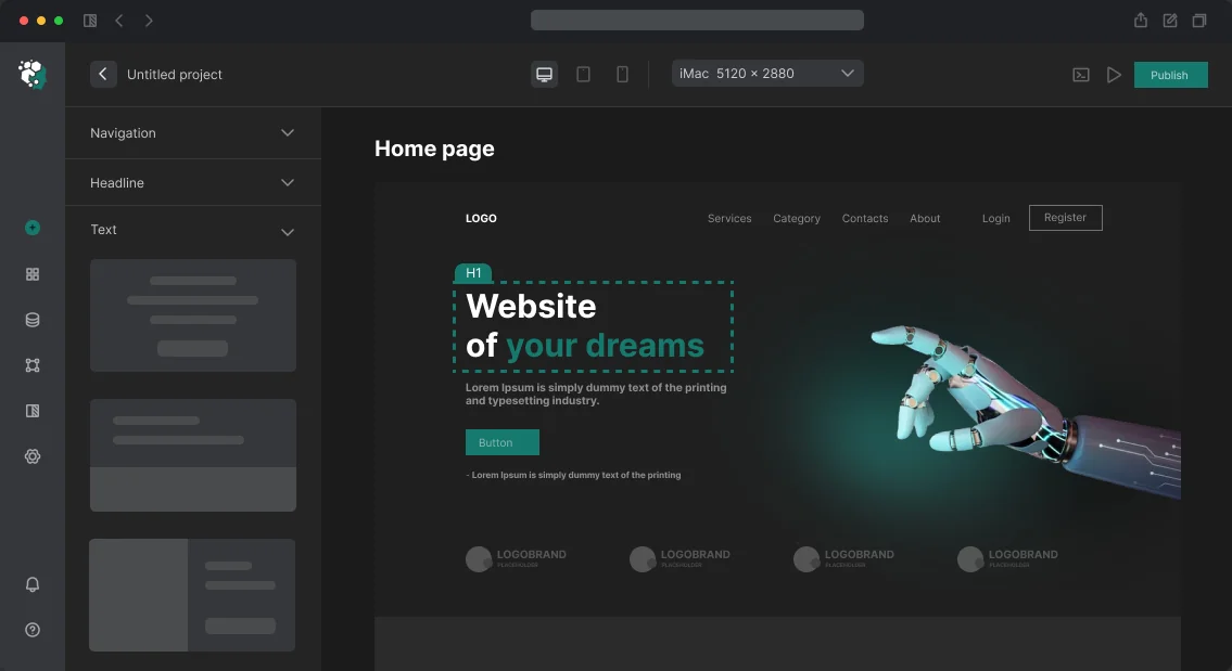
Реалізація Geolocation API на сайті
Уявіть: інтернет-магазин визначає найближчий пункт видачі, сервіс доставки показує кур'єра на карті, а туристичний портал будує маршрут прямо в браузері. Але Geolocation API — річ тонка: одна відмова користувача або вимкнений GPS — і координати втрачені. Клієнти часто стикаються з тим, що застосунок падає без обробки помилок або показує невірні дані через низьку точність IP-геолокації. Одного разу ми взяли проєкт із трекінгу кур'єрів: через відсутність fallback на ручне введення при відмові геолокації сервіс втрачав до 30% замовлень. Після доопрацювання UI-пасток втрати скоротилися до нуля. Наша команда з багаторічним досвідом у frontend-розробці береться за інтеграцію так, щоб ваш застосунок працював стабільно навіть при поганому сигналі. Зв'яжіться з нами — ми оцінимо проєкт за 1 день.
Як працює Geolocation API?
Браузер використовує комбінацію джерел: GPS (на вулиці), WiFi-тріангуляцію (у приміщенні) та IP-геолокацію (резерв). Точність варіюється від метрів до кілометрів. Гарантуємо, що ваш код коректно обробляє всі три стани: успіх, помилку та таймаут.
| Джерело |
Точність |
Умови |
| GPS |
5–10 м |
На вулиці, відкрите небо |
| WiFi |
10–50 м |
У приміщенні, щільна забудова |
| IP |
1–20 км |
Резерв, груба оцінка |
Які проблеми вирішує інтеграція Geolocation API?
Відмова користувача в доступі
Користувач може заборонити геолокацію. Без обробки помилки застосунок падає. Ми додаємо fallback: вручну ввести адресу або вибрати місто. Типовий код:
if (error.code === 1) {
  // показати форму ручного введення
}
Неточність IP-геолокації
На десктопі без GPS точність часто >1 км. Ми використовуємо enableHighAccuracy: true і перевіряємо accuracy — якщо більше 100 метрів, пропонуємо уточнити адресу.
Зависання при довгому запиті
За замовчуванням таймаут не заданий. Встановлюємо timeout: 10000 (10 секунд). На практиці 70% запитів з GPS укладаються в 5 секунд, з WiFi — до 10.
Як ми це робимо: стек і підхід
Інтеграцію ведемо на TypeScript з React, Next.js або чистому JS. Приклад — наш React-хук, що обгортає getCurrentPosition і watchPosition, повертає { position, error, loading, getWatch, stopWatch }. У продакшні використовуємо Geolocation API (документація MDN).
Для розрахунку відстаней застосовуємо формулу Гаверсинуса. Вона швидша за альтернативи (наприклад, Vincenty) і дає похибку до 0,5% на дистанціях до 1000 км. Цього достатньо для пошуку найближчих об'єктів.
Чому точність геолокації може знижуватися?
Навіть з enableHighAccuracy: true точність падає через щільну забудову, погану погоду або вимкнений GPS на пристрої. Завжди передбачайте fallback-сценарії: ручне введення або вибір зі списку.
Докладніше про фактори точності
Точність залежить від кількості видимих супутників, наявності WiFi мереж і калібрування GPS приймача. У деяких пристроях GPS вимикається в енергозберігаючому режимі. Ми тестуємо на різних пристроях і браузерах (Chrome, Safari, Firefox) з різними налаштуваннями.
Запобігання типовим помилкам
Помилки при роботі з Geolocation API легко запобігти. Завжди обробляйте коди помилок: відмова (1), недоступність (2) і таймаут (3). Встановлюйте таймаут timeout: 10000, щоб запит не висів вічно. Перевіряйте accuracy при наявності GPS — якщо точність нижча за поріг, запропонуйте уточнити дані. Не забувайте очищати підписку watchPosition при демонтуванні компонента, щоб уникнути витоків пам'яті.
Що входить у роботу
- Аналіз сценаріїв використання (карта, трекінг, пошук найближчих).
- Розробка утиліт для роботи з геолокацією (хуки, обгортки).
- Інтеграція з картами (Leaflet / Google Maps / Mapbox).
- Обробка помилок і fallback-механізми.
- Тестування в браузерах і на реальних пристроях.
- Документація коду та інструкція з підтримки.
- Деплой і налаштування моніторингу.
Процес роботи
- Аналітика — визначаємо сценарії: карта, трекінг, найближчі точки.
- Проєктування — структура обробки помилок і fallback.
- Реалізація — пишемо утиліти, хук та інтеграцію з картою (Leaflet / Google Maps / Mapbox).
- Тестування — в різних браузерах і умовах (GPS, WiFi, IP).
- Деплой — код у репозиторій, документація.
Терміни орієнтовно
| Тип роботи |
Термін |
| Базова інтеграція (один запит + карта) |
0.5–1 день |
| Трекінг + гаверсинус + оптимізація помилок |
1–2 дні |
| Комплексне рішення (кешування, офлайн) |
3–5 днів |
Вартість розраховується індивідуально — отримайте консультацію, ми обговоримо деталі. Зв'яжіться з нами, щоб обговорити ваш проєкт. Ми впровадили геолокацію в 20+ проєктах: від доставки їжі до геочатів. Досвід показує, що 80% помилок припадає на відмову користувача або поганий сигнал — це вирішується UI-пастками. Гарантуємо підтримку всіх браузерів з Geolocation API та акуратний код без витоків пам'яті.
Фронтенд-розробка React: від аудиту до production
Бандл виріс до 3.1 MB gzip — це реальна цифра з проєкту, який прийшов до нас на аудит. Причина: moment.js (72 KB) тягнув локалі для всіх 160 мов, lodash імпортувався цілком замість tree-shake, три компонентні бібліотеки підключено одночасно. TTFB відмінний, але TTI (Time to Interactive) на мобільному — 14 секунд. Користувачі йшли, конверсія впала на 40%. Ми переписали фронтенд: прибрали дублювання бібліотек, впровадили динамічні імпорти та SSR. Результат — бандл зменшився до 850 KB gzip, TTI — 2.1 секунди, LCP — 1.8 с.
Frontend — це не «намалювати красиво». Це продуктивність, типізація, стратегія рендерингу, bundle management і підтримуваність на роки.
Чому Next.js — стандартний вибір для SEO?
React — наш основний UI-фреймворк для складних інтерфейсів. Next.js — стандартний вибір для проєктів з SEO-вимогами або SSR. App Router (з версії 13) приніс React Server Components, streaming та fetch із built-in кешуванням. Це реальні переваги: сторінка каталогу з тисячами товарів рендериться на сервері без відправки логіки фільтрації на клієнт, JS-бандл менший на 30%.
Але App Router — інший спосіб мислення. "use client" потрібно ставити свідомо. Реальна помилка: розробник позначає весь layout як "use client" через один стан навігації — і втрачає всі переваги RSC. Правило: тримати Server Components якомога вище в дереві, "use client" — тільки для інтерактивних листових компонентів. ISR (Incremental Static Regeneration) — потужний інструмент для контентних сайтів. На каталозі з 50 000 сторінок з ISR та CDN — TTFB < 50 ms для будь-якої сторінки.
Як TypeScript запобігає багам у продакшені?
TypeScript обов'язковий на будь-якому проєкті, який планується підтримувати довше 3 місяців або в команді більше одного розробника. Аргумент «пишемо швидко без типів» працює лише перші 2 тижні. Після — баги, пов'язані з невизначеними значеннями, виникають щотижня.
Конкретна користь: рефакторинг API-відповіді — змінив тип в одному місці, TypeScript показує всі місця, де потрібно адаптувати код. Без типів — баг у продакшені через тиждень. strict: true в tsconfig.json — обов'язково. noImplicitAny, strictNullChecks, strictFunctionTypes. Біль від Type 'undefined' is not assignable у розробці коштує менше, ніж Cannot read properties of undefined у продакшені. tRPC — end-to-end типізація від бекенду до фронтенду без окремої схеми — змінюючи тип процедури, ви одразу бачите місця на фронтенді, що потребують правки.
Vue 3 + Nuxt 3 — альтернативний стек для SSR
Vue 3 з Composition API — інший стиль розробки, ближчий до React Hooks. <script setup> та composables роблять код більш перевикористовуваним. Nuxt 3 — фреймворк для Vue з SSR/SSG, аналогічний Next.js. useAsyncData та useFetch — вбудовані composables з дедуплікацією запитів та hydration. Auto-imports зручні, але можуть заплутувати при debug. Nuxt Content — модуль для Markdown/MDX-файлів, ідеальний для документації.
Hydration mismatch — специфічний біль SSR на Vue та React. Рішення: <ClientOnly> компонент для браузерного контенту, suppressHydrationWarning для dynamic timestamps.
Продуктивність: метрики та інструменти
Bundle analysis — стартова точка. @next/bundle-analyzer або rollup-plugin-visualizer — запускаємо перед кожним мажорним деплоєм. Мета: жодна сторінка не повинна вимагати > 200 KB JS gzip для first paint.
Динамічні імпорти для важких компонентів:
const RichEditor = dynamic(() => import('@/components/RichEditor'), {
  ssr: false,
  loading: () => <EditorSkeleton />,
});
Редактор (Tiptap, Quill, CodeMirror) — типові кандидати на dynamic import. Без цього вони потрапляють в основний бандл. React DevTools Profiler — для пошуку зайвих ре-рендерів. React.memo, useMemo, useCallback — точкові інструменти. Передчасна мемоізація всього підряд додає overhead без користі. Профілюйте спочатку, оптимізуйте потім.
Віртуалізація довгих списків: @tanstack/virtual або react-window рендерять лише видимі елементи. Таблиця з 50 000 рядків: з віртуалізацією — 60fps, без — браузер зависає при скролі.
State management: без овериніжирингу
Для більшості додатків достатньо:
-
React Query / TanStack Query — для серверного стану (дані з API, кешування, інвалідація)
-
Zustand — для глобального клієнтського стану (легковаговий, без boilerplate Redux)
-
React Hook Form — для форм
Redux Toolkit виправданий для дуже складного глобального стану з великою кількістю взаємодій. Для більшості задач — це overkill. Recoil, Jotai — атомарні підходи для незалежних шматків стану.
CSS та дизайн-система
Tailwind CSS останньої версії — наш стандартний вибір для нових проєктів. Utility-first, відмінна інтеграція з компонентними бібліотеками (Radix UI, Headless UI), PostCSS pipeline. CSS Modules — альтернатива, коли потрібна більш явна ізоляція стилів. Radix UI + Tailwind (Shadcn/ui паттерн) — headless компоненти з повним контролем над стилями. Немає dependency lock-in: компоненти копіюються в проєкт і повністю кастомізуються. Storybook — для документування компонентної бібліотеки.
React DevTools Profiler — офіційний інструмент від команди React.
Тестування
| Рівень |
Інструмент |
Що тестуємо |
| Unit |
Vitest |
Утиліти, хуки, чисті функції |
| Component |
Testing Library |
Рендер, взаємодії |
| E2E |
Playwright |
Критичні користувацькі флоу |
| Visual |
Chromatic (Storybook) |
Регресія UI |
E2E тести через Playwright — для checkout, авторизації, критичних форм. Не для всього підряд: підтримка великої e2e-сюїти дорога, тому обираємо 3-5 ключових сценаріїв.
Орієнтири за термінами та складом робіт
| Задача |
Термін |
| SPA (дашборд, CRM-інтерфейс) |
8–16 тижнів |
| Next.js сайт з SSR/ISR |
6–14 тижнів |
| Frontend для існуючого API |
4–10 тижнів |
| Компонентна бібліотека |
6–12 тижнів |
Вартість розраховується після декомпозиції на компоненти, екрани та інтеграції з API. Ми використовуємо N+1 оцінку: додаємо 20% на ризики.
Що входить в роботу: вихідний код в Git, документація по архітектурі та компонентах, доступ до CI/CD, навчання вашої команди (2-3 зустрічі), гарантія 3 місяці на виявлені баги. Додатково — покриття юніт-тестами ключових модулів.
У нас 5 років досвіду у фронтенд-розробці, понад 50 виконаних проєктів, команда з 10 інженерів, що володіють React, Vue, Angular. Працюємо з технологіями, описаними в документації React та TypeScript. Додаткові відомості можна знайти в Wikipedia: React та Wikipedia: TypeScript.
Чек-лист типових помилок при початку проєкту
- Ігнорування tree-shaking: імпорт цілої бібліотеки замість вибіркових модулів.
- Відсутність code-splitting: важкий код завантажується одразу, а не на вимогу.
- Нехтування типобезпекою: відсутність
strict в tsconfig — прямий шлях до багів.
- Надмірна мемоізація:
useMemo та useCallback там, де вони не потрібні.
- Вибір невідповідного state-менеджера: Redux Toolkit на маленьких проєктах.
Який стек обрати для фронтенд-розробки React?
Ми порівнюємо інструменти за реальними метриками. Next.js швидший за Nuxt у збірці SSR на 20–30% при однаковому розмірі сторінки. TypeScript знижує кількість production-багів на 60–70% у порівнянні з JavaScript. Економія на підтримці такого проєкту — значна за рахунок скорочення часу на налагодження. Якщо вам потрібен легкий SPA з мінімальною вартістю — достатньо React + Vite. Для контентного сайту з SEO — Next.js з ISR дає TTFB нижче 50 мс навіть при 50 000 сторінок.
Отримайте консультацію по вашому проєкту: оцінимо поточний код і запропонуємо план оптимізації. Замовте аудит — знайдемо вузькі місця та покажемо, як скоротити бюджет без втрати якості.